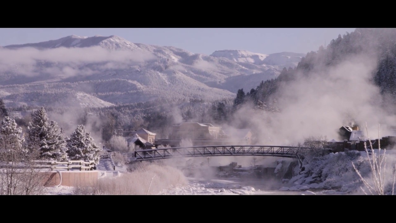
Explore the San Juan Mountains
Sourrounded by over 3 million acres of national forest and wilderness areas, you’ll find yourself in the center of nature’s playground in Pagosa Springs. With the San Juan Mountains and a variety of outdoor activities at your doorstep, along with hot springs, charming shops, historic sites, and an assortment of artisans, you'll find plenty to do in Pagosa.
Biking in Pagosa Springs
The Pagosa Springs area contains a wide variety of biking opportunities on paved roads, forest service roads and singletrack - all offering amazing views wth a variety of routes and terrain. With virtually endless miles of national forest, Pagosa Springs an ideal biking destination for riders of all skill levels. Learn more area trails, routes and conditions at www.pagosatrails.net.
The Hub
Uptown Pagosa Springs
100 Country Center Dr., Pagosa Springs, CO 81147
Pagosa Outside
Downtown Pagosa Springs
Pagosa Springs, CO 81147
(970)264-4202
view website
Pedal & Powder
Downtown Pagosa Springs
527 San Juan Street, Suite A
Pagosa Springs, CO 81147
(970)264-1800
view website
North Pagosa Blvd, Piedra Blvd and Hwy 160 (Loop)
Uptown Pagosa Springs
View Detailed Route Description
Difficulty: Easy
Distance: 14.45 miles
Elevation Gain: 1,210 feet
Getting There: Hwy 160 to North Pagosa Blvd.
Hwy 160 to Treasure Falls (Out and Back)
View Detailed Route Description
Difficuty: Easy
Distance: 28 miles
Elevation Gain: 1,675 feet
Getting there: Start from the junction of Hwy 84 and Hwy 160.
Town to Wolf Creek Pass (Out and Back)
View Detailed Route Description
Difficulty: Advanced
Distance: 46 miles (to top of pass and back to town)
Elevation Gain: 4,000+ feet
Getting there: Start from the junction of Hwy 84 and Hwy 160.
For addiitonal routes and more detailed information, visit www.pagosatrails.net.
Reservoir Hill
Downtown Pagosa Springs
View Detailed Trail Description
Difficulty: Beginner to Advanced
Distance: 1.4 to 4 miles
Elevation range: 7,280 to 8,000
Maps: Available at each trailhead, at local bike shops and the Chamber of Commerce Visitor Center.
Getting There: Two trailheads access Reservoir Hill: Spa (above the Spa Motel on Hot Springs Boulevard) and San Juan (behind the San Juan Motel, on U.S. 160).
Eightmile Mesa
View Detailed Description
Difficuty: Intermediate; long mileage with one steep four-mile hill
Distance: 14.4 miles
Elevation Range: 7,200 to 8,040
Maps: San Juan National Forest, Serviceberry Mountain Quad
Getting there: From the junction of U.S. 160 and U.S. 84 at the east end of town, drive five miles south on U.S. 84 to Eightmile Mesa Road, identified by a Forest Service sign on the right. Travel up Eightmile Mesa Road a little over a mile, passing the entrance to the Loma Linda subdivision, then reaching the Forest Service gate. Park here.
Jackson Mountain (with Snowball Road Loop)
View Detailed Description
Difficulty: Beginning skills with intermediate fitness level, two river crossings
Distance: 22 miles
Elevation Range: 7,200 to 8,200
Maps: San Juan National Forest, Jackson Mountain Quad
Getting there: The Snowball Road loop starts and ends in downtown Pagosa Springs. Other loop options start on Jackson Mountain, 6 miles east of Pagosa on Hwy 160.
Turkey Springs Double Loop
View Detailed Trail Description
Difficulty: Beginner to intermediate
Distance: 14.1 miles
Elevation Range: 7,600 to 8,100
Getting There: From the junction of U.S. 160 with Piedra Road, go north on Piedra Road for 6.4 miles. Turn left on the graded Turkey Springs Road (Forest Road 629), which intersects Piedra Road shortly after you pass over a cattleguard. Drive 1.2 miles on Forest Road 629 to Newt Jack Road (Forest Road 923) on your left. Park here and start your ride.
For addiitonal trails and more detailed trail information and conditions, visit www.pagosatrails.net. Trail information courtesy of www.pagosatrails.net and “PAGOSA RIDES; Mountain Biking in and around Pagosa Springs” by Gary Hopkins.